The Canal Parks: Sand Island Park

I made a trip over to Sand Island Park in Bethlehem this weekend and upon arriving, the first thing I did was to climb the stairs and walk across the bridge. Without saying too much about it because so much has already been said, the first thing I think about when I think of Bethlehem is the Steel. The blast furnaces and various other parts of the factory still remain along the river there and to someone my age who cannot remember what the sight was like when the plant was active; there is a certain awe that develops at their presence. The countless artists and photographers that have made the Steel their subject can attest to it.

Here on the banks of the Lehigh River is a living monument to human evolution and despite its silent activity it still speaks volumes of our history and of the history of this nation. About ten years ago, on a family trip to Morgantown West Virginia, I took a walk from our motel across a nearby bridge. The cornerstone on the bridge read: “Bethlehem Steel”. It was awesome to see that.
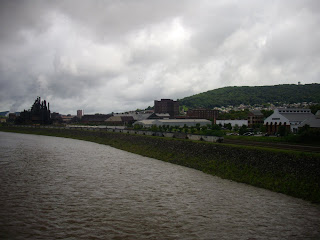
The Lehigh River was swollen that day from excessive rain the night before and the red gravel path in Sand Island Park had suffered from it as well. For the record, this park is beautiful.


This park is located between the Lehigh River, the Monocacy Creek and the Lehigh Canal. There are stairs that lead from the main path down to wooden “piers” on the creek.


At the end of the red gravel trail there is an area that provides amazing views of the Blast Furnaces. I was told by a gentleman that there is usually more land to walk on but due to the high level of the water, it wasn’t there that day.

Here, a bridge crosses the creek and allows access to the same D&L towpath in our Canal Park. This towpath stretches from here to Easton and back to Allentown to the west.


The canal here is very stagnant and the water is mostly gray.

I walked back to the parking lot along another red gravel trail.

There are basketball courts by the parking lot and a playground. Sand Island has a very unique design that allows for both passive and active recreation. It seems as if the passive and active are separated from the trail system by design.

Next to the playground there are is a wonderfully preserved section of canal. I have not seen anything like this before. The water of the canal actually moves across a bridge over the Monocacy. There is some great signage here that allows a visitor to the park some historical information.


My visit to Sand Island Park was intended to allow me to compare and contrast with our Canal Park. You see, Sand Island is developed and designed to allow a park visitor to experience the great amount of history that surrounds it. The park itself is in immaculate shape and during my visit two different police cars drove through on inspection. Canal Park can learn a few things from Sand Island Park but it is my belief that with some help, Canal Park could end up the better of the two.
Canal Park, as I have stated before, has limitless possibility. I am not a park planner so I will not assume to know what exactly can be done. I do know some things that should be done and visiting Sand Island Park cemented my thought process. Like Sand Island, the trails at Canal Park without a doubt could benefit from some lighting.
Canal Park could also use some of that wonderful D&L signage. Most importantly, I believe that once the existing facilities in Canal Park are cleaned up and maintained it will already be on its way. We need to see that boathouse reopened and canoes in the canal as well. It would serve as an excellent drawing point and I believe it would encourage more usage in a park that is not used enough.
What do you think should be done to Canal Park?
On my way out of Sand Island, I saw that the park continued in what is called Sand Island West. This section of park seems to currently be involved in development and a lot of it seemed to be suffering the ill effects of Musikfest which had ended the night before. Despite the state it was in, this area of Sand Island provided some majestic views of the Lehigh River.


Here again, the D&L towpath making its way back to Allentown. I was on my way back too.

Labels: Sand Island Park, The Canal Parks


4 Comments:
Well said.
I lived in Bethlehem for 3 years and this park was a favorite for my partner and I. We really dug it.
I recommend you check out Matt Yglesias over at Think Progress, he writes a great deal about urban development and could provide you with some of that "park planning" thinking you alluded to above.
Anyway, thanks for the post. It brought back fond memories of the east coast.
If the parks close at dusk, why is lighting necessary?
Our Bike Ride From Sand Island to RT33 Boat Launch PIX Slideshow
LVCI,
Some of our pictures are eeriely similar. Thanks for sharing. If I could ride a bike I would love to make that journey myself.
Also, I expected Ed Hanna to jump in there with the local forecast.
Post a Comment
Subscribe to Post Comments [Atom]
<< Home